Showing posts with label profile. Show all posts

Wednesday, 29 January 2014

Alexandra Women's Tour of the Reservoir

12.04.2014
Edmundbyers, England
Road Race, 67.8km
E/1/2/3/4
54°51'27.76"N  1°59'17.62"W
Race Entry

Women's cycling in Britain is desperately in need of some longer races so that the riders have an opportunity to show the public that they're fully capable of completing "proper" events, which will help to finally kill off the misconception that women's sports are not as interesting, exciting or worthy of attention as men's sports. For that reason, the warm welcome received by the announcement that the Tour of the Reservoir would include a women's race for the first time in its history this year was somewhat tempered by the fact that the women will race on a much shorter parcours than the men.

However, the race organisers explained that this year, they'd been unable to organise a race as long as they'd have liked because the road closures they'd been able to secure were limited - and if the 2014 edition proves to be a success, they'll be permitted longer closures in 2015 and thus be able to organise a much longer women's race held on a separate day to the men's. The men's Tour has been highly popular for many years now and is popularly considered to be one of the most challenging races in the country; the women's race, therefore, could become a real showcase for the sport if it's successful this year. As fans, we can make sure that happens - by making sure everyone knows about it and the plans the organisers have for its future, and by going to see it. Remember: the more spectators that show up, the more sponsors show interest.

While the Tour might not be very long, anyone who turns up thinking it'll be easy is in for a shock: along with the Rutland-Melton Classic, this is about the closest women's racing in Britain comes to the infamously difficult Flemish classics - in fact, with the tough climbs dotted along the parcours and the often inclement weather frequently experienced in County Durham and Northumberland in April, this might very easily become one of the hardest women's races in Europe.

Neutral Service reader (and now, contributor) David White lives near the parcours and rides on the same roads regularly. He gave us a brief description of the route...
The character of the race is very much determined by the course and in the case of the Tour of the Reservoir also by the exposed nature of it as well.  The riders HQ is in the village of Blanchland and they roll out of the village on the B6306 a climb out of the village and steady undulating road brings them to Carrick’s Corner at the head of the reservoir and here the race starts. The road climbs away from the reservoir itself and climbs steadily with a few switchbacks thrown in for good measure before dropping down into the village of Edmundbyres. 
Here the route heads off downhill on the B6278 before turning right and riding over the dam of the Derwent Reservoir.  From here they roll down from the dam to rejoin the B6278 next to the River Derwent, a short section of twisting road then opens out from a left hand bend to reveal the main climb of the route.  
Starting as a gentle incline the climb gets serious as soon as the riders fork left off the B6278 and head up towards the Manor House pub on the A68.  The climb is approximately 700m long and averages 8% gradient with a few kicks along the way.  If the riders are lucky the prevailing wind will be on their backs, if not it will be even harder work. 
The riders go onto the A68 and head north following the ridgeline for a short section before leaving the A68 onto and unclassified road heading up to Barleyhill, the highest point on the course.  The road is undulating and exposed but the actual climbing is very gentle.  At Barleyhill the riders make two left turns in quick succession and start to descend back to the reservoir.  I hope some road repairs are done before the event as several large potholes could cause serious damage if not.   
The riders will be flying as they turn and follow the northern shore of the reservoir past the yacht club before reaching a rolling section of road that takes them to the head of the reservoir.  There are some beautiful views of the reservoir along this section however I don’t think the riders will have time to notice! 
At the head of the reservoir the riders make a left turn to join the B6306 to head back towards Edmundbyers completing the lap. The finish of the race will be at the top of the dam, but with a revised way of getting there.  Instead of turning off and riding over the dam itself the riders continue on the B6278 to the bottom of the valley and go over the river Derwent and then into the dam area.  This gives a short climb to the finish at the top of the dam to crown a worthy victor.

The Parcours


View Tour of the Reservoir in a larger map


Much of the parcours is extremely exposed, making the going difficult in even relatively light wind due to the altitude. The prevailing wind around the reservoir blows from the north, meaning that the riders are likely to have to contend with crosswinds from the left for most of the route along the B6306 and B6278, a headwind along the A68, crosswinds from the right  as they travel east along the northern flanks of the reservoir. There are numerous steep sections, including one greater than 10% approaching the finish line, as well as numerous steep descents and difficult corners. Combined, all of these factors make for a very technical and challenging parcours.

Guide to map symbols
0-5km
The race begins on the B6306 at the westernmost end of the reservoir, heading north-east - the low stone wall down a bank on the left side of the road and the spindly conifers beyond it will do little to calm cross winds blowing down the hillsides over the valley, across the water and straight into the riders' paths, possibly splitting the bunch into several groups only a few metres into the race if blowing with sufficient strength. The road also travels uphill here. After 0.5km, the route passes by some cottages on the left; 100m further on, where the road passes between woodland on both sides, there is a section where a small brook often overflows onto the road after heavy rain (1 Caution, marked by a yellow pin, on our map) - a potentially slippery point, but on  a straight road and thus not especially hazardous. Crosswinds are likely to be even stronger when the riders emerge from the woods.

After 1.1km the parcours passes more woodland, then some buildings on the left before reaching the first bend, a fairly tight right-hander. A farm vehicle entrance right on the apex of the bend may cause mud on the road (2 Caution) and any small lead groups might be able to add a few seconds to their advantage at this point, being able to take advantage of the wind that, now blowing from behind, will allow them to sail up the short hill like land yachts while the riders in the pack behind them have to take things slower to avoid crashing. The road over the hill carries the race into what is unmistakably mountain moorland; at 2.49km, where a track leads off to the left (3 Caution; by the woods), there may be loose gravel on the road.

At 3.13km the road bends slightly right, then sharply left before entering a fast, sweeping left; the road is wide here and the bends can be taken at high speed. The green barn to the left of the road at 3.63km marks the beginning of the biggest and steepest climb so far - over the next 0.3km, the riders will climb 21m to 293m above sea level at an average gradient of 7.1%. The second half of the climb is steeper; according to Google Earth data, it reaches 10.4% at the slight right bend 3.85km into the parcours before slackening as it approaches the summit where a small lay-by provides an ideal spot for spectators*.

From 4.17km, the road starts to descend - the start of the descent is marked by a house high above on the right, but it's hard to see from the road; the first hundred metres is very steep in parts. Approximately halfway down the riders arrive at Edmundbyers where, 4.73km from the start, they keep left to follow the road as it veers to the east (4 Caution). Some caution is required here as riders who fail to brake in time from the descent run the risk of crashing into the metal railings running along the right-hand side of the road. Meanwhile, there is a danger of loose gravel along the left of the road.

5-10km
The road continues to descend through the village, reaching a left turn onto the B6278 at a T-junction (5 Caution; look for the "finger" signpost pointing left to Shotley Wood and the large red double doors on the house over the road) at 5.07km. The turn isn't difficult but the white lines painted on the road may become slippery when wet. The road then continues to descend, steeply in parts, for the next 1km before arriving at the left turn onto the road that will carry the race up to and over the dam.

The dam wall
(image: Dennis Lovett CC BY-SA 2.0)
Turning left at 6.08km onto a much narrower road to continue to the dam, the riders arrive at a pinch point when they have to pass through a narrow gate (6 Caution) - leading riders, either solo or in small groups, will be able to get through and continue far quicker than the main group, but all riders will be slowed significantly as the gate also has a cattle grid. The road beyond the gate is narrow, giving any climbers at the front of the bunch an opportunity to get away up the hill climbing up to the dam which, while short at 0.5km, reaches 6%. Once there, they begin one of the most spectacular sections of any race in Britain, riding along the top of the dam wall - where, if there's a strong crosswind blowing off the reservoir, the heavier riders may be able to catch them. The short ramp up to the opposite end, meanwhile, allows them further opportunity, being as steep as 7%; the heavier riders then have another chance to catch up from 7.59km (7 Caution) on the steep descent leading back down to the main road, which in parts is near -13%.

At 8.22km, having reached the bottom of the descent, the riders negotiate a tight, fast left-hand bend to rejoin the B6278; they now follow the road as it begins to climb gently to 9.27km, where the biggest climb of the parcours begins. Rising 69m in 0.93km, the average gradient is 7.7%, which is plenty steep enough; however, Google's mapping data puts the steepest section (just after the left-hand turn at 9km) at 9.1% and while it's probably too far from the finish line for an individual to emerge as sure-fire winner, we are likely to see the group from which the winner is selected get away here during the final lap. On each lap, the first riders to the top will be awarded primes.

10-15km
Manor House Inn, at the top of the prime
(image: Duncan Grey CC-BY-SA 2.0)
The Manor House Inn marks 10km from the start as well as signaling the end of the climb; due to the altitude and exposed terrain just after the left-hand turn onto the A68, the riders are likely to turn into a strong headwind here - another opportunity for the heavier riders to catch up with any climbers who got away on the way up.

The 0.8km from the turning is flat and ends at a fork where the riders will keep left to join a narrower road which remains flat for 0.5km, then climbs 19m in 0.5km (average 3.8%; maximum, in the second half, 6.2%). A short flat section then leads to 12.6km, where another short climb begins - due to the rough track crossing the road here, this may be a hazardous spot with mud and sharp stones on the road. The end of the road, at 13.3km and 306m above sea level, is the highest point on the parcours; the race turns left here and continues for 0.37km, with riders getting some much-needed shelter from the wind by the conifers on the right side of the road, before turning left again to begin the long descent that will take them along the northern side of the reservoir and towards the beginning of a new lap.

The descent, 2.4km long, continues past the next left turn (just past the large grey house and it's best to keep a short way out from the left verge as there are a few potholes in the road) and doesn't get very steep over the first 2km, thus allowing all but the most downhill-phobic climbers to retain any lead they gained on the preceding sections.

15km-End of circuit
The final 0.4km of the descent becomes much steeper, reaching -8.8% as the road follows a sweeping right-hand bend (9 Caution) - the road is wide enough for the bend to be taken at very high speed, but caution is required and with loose verges on both sides of the road the safest place to be is the centre. Unless it's raining, of course, in which case the white lines are going to be slippery.

Following the descent, as the road begins to bend gently to the left, the terrain flattens out considerably - there are a few small climbs, some steep, on the way around the reservoir but no more testing climbs to come for the next 3.5km. This, especially on the final lap, evens things up: any climbers that got away earlier can be caught (especially if they were one of the rare types that can descend, too) and it's a good opportunity for the teams to regroup and get their potential winners into position for the final assault on the finish line. At 15.9km, the reservoir comes back into view on the left; 400m later, with the reservoir once again hidden by trees, the riders come to a short but tough small climb of 0.2km with a maxiumum gradient of around 6% (white fences on both sides of the road mark the beginning and end). The short descent and flat 1km that follows is another point where climbers will have to work hard to maintain a lead.
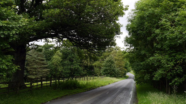
Descent to the bridge, Carrick's Haugh
(image: Trevor Littlewood CC-BY-SA 2.0)
At 17.6km, where a track crosses the road and may lead to mud and gravel on the tarmac (10 Caution), the road bends left and begins another short climb of around 0.2km length with a maximum gradient of 6.5%, ending at the farm. The next two kilometres running to the westernmost end of the reservoir are rolling but free of steep ramps making this a relatively easy section, with the only real issue being the descent from 18.6km (maximum -4.6%), which takes in a medium left bend followed by a tight right (11 Caution). Both have loose verges and may be slippery. At 19.7km, the riders reach another left leading into a short descent at Carrick's Haugh, then find themselves on a bridge where care is needed not to crash on the verge running along the right (12 Caution). The bridge serves as a handy marker for the start of the final climb on the circuit, a tough 0.4km section starting from 19.9km and gaining 33m by the time the riders arrive back at Carrick's Corner, where they earlier joined the circuit - the average gradient is approximately 8.25%; the maximum, which can be avoided by staying away from the left verge as the road joins the B6306, is 14%.

Final section
After completing three laps of the circuits, the riders will take a different route (marked in red on our map) to the finish line. Beginning at Carrick's Corner, they take the same route towards the dam but this time do not turn left to ride up onto it at 6.08km. Instead, they continue along the B6278 for 0.87km to the point where, earlier, they rejoined the B6278 following the descent down from the dam. Here they turn left, and the descent they tackled earlier, with its maximum gradient of 13%, becomes an ascent that is more than tough enough to shake up the order at the front of the race. The finish line is at the dam.

*Note: The lay-by only really has room for one or two cars. That means, of course, that there's space for about a hundred bikes - so if you're planning to see the race from that point, get there on your bike if you can so that other people will be able to do the same. The more the merrier - take a barbecue and some beers and have a party.


Start List
Not yet available


Getting There
Please note: Derwent Reservoir (County Durham/Northumberland) should not be confused with the reservoir of the same name in Derbyshire.

The parcours is best reached from the south via the A68, from the north via the A69, from the west via the A6079 and from the east via the A694, A692 or A693. Google Maps has an excellent application that can design routes suited to cars or bikes.


Staying There
The local inns offer accommodation, but this is very limited and likely to be booked up well in advance. There is a Youth Hostel at Edmundbyers and also Durham (37km), which as a popular tourist destination has several hotels. There is also a campsite (tents and caravans) at Edmundbyers (postcode DH8 9NN), but people planning to camp should be aware that the weather can be very bad in April.

Monday, 11 November 2013

Curlew Cup 2014

22.06.2014 Official Site
England, 103km Road Race
Women's National Series

Now in its third edition, the Curlew Cup has become one of the most popular National Series races among riders and fans alike for numerous reasons: the high-calibre field it attracts (Sarah Story won in 2012, then Hannah Barnes in 2013), the beautiful route running through the Northumberland countryside, a respectable prize fund (£2000 in 2014) and, perhaps most of all, a hard and testing parcours - while some races organisers, even to this day, seem to think that female cyclists can't cope with difficult roads, the Curlew organisers know they relish a challenge and appreciate an opportunity to show their athletic ability and technical skills, so they've come up with a testing 103km circuit that has much in common with the (in)famous Flemish Classics and promises some very exciting racing indeed. Two especially notable sections are the very narrow roads stretching between the points marked as the 14th and 15th corners and the 16th and 17th corners on our map. In addition to a variety of hazards caused by loose road surfaces and mud, both of these sections are sufficiently narrow that team cars may experience problems reaching a rider who finds herself in difficulties, which can easily result in loss of a significant amount of time.

The Parcours

View Curlew Cup 2014 in a larger map


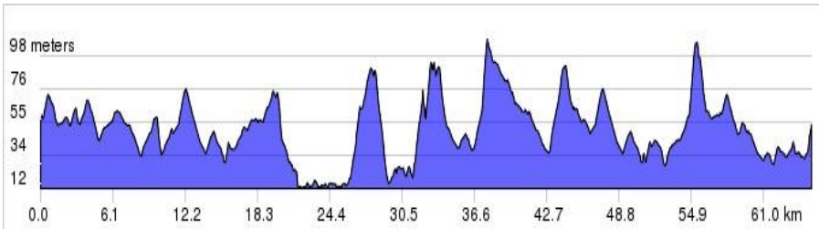
Altitude profile
Something of a sprinters' race in previous editions, the Curlew Cup features more climbing this year - but not too much; the organisers seem to be aiming for a similar concept to Italy's Trofeo Binda, a race that takes place on a near-perfectly balanced parcours that does not allow either the sprinters or the climbers to gain a race-winning advantage until near the end. However, their bike-handling skills will be put to the test: in addition to the gravel and mud on those narrow roads, much of the parcours - especially the hilltops - are very exposed and subject to powerful crosswinds, another factor that riders with experience of the Flemish Classics will be best placed to deal with.

The Women's National Series race consists of three laps of the shorter 22.37km (13.9 miles) circuit depicted in blue on our map followed by one lap of the 35.89km (22.3 miles) circuit, depicted in red on our map. The official distance given is 62 miles, which is equal to 99.78km; I think it's more like 103km.

22.37km Circuit
A number of small climbs along the parcours seem, at first, to present little challenge; however, the effect of the brief steeper points on them will accumulate as the three laps progress. Although that seems to give climbers a small advantage, the heavier riders and sprinters have plenty of opportunity to take back time over the last half of the circuit as it's almost entirely downhill from the 7th Corner to Stamfordham - with a number of difficult corners where the lightweight climbers find it harder to maintain control at high speed still to come, there is little opportunity for anyone to gain an unassailable lead before starting the longer circuit.

Start
Riders set out from Stamfordham's attractive village green near to the 18th Century market cross (which can be seen circa 1900 in this photo), on section of road sufficiently straight and wide for a fast start to the neutral zone.

1st Corner
In the first kilometre, a slight climb leads into the first corner, a wide left-hander to join the B6309 heading north, then up another short but steeper climb (maximum, though only briefly, 7.7%) and into a flat and exposed section through fields to Heugh, 1.25km from the start. Beginning at 2.2km, a little past Heugh, is another short climb nearing 4% at the steepest point. The top is marked by some farm buildings on the left and the descent isn't long enough to make much difference to anyone.

2nd and 3rd Corners 
1st lap: (2.98km, 4.44km)
2nd lap: 25.35km, 26.81km
3rd lap: 47.72km, 49.18
At 2.97km lies a relatively tight right-hand bend which, due to a wide gap in the left-side hedge at the apex, could prove technical if strong winds are blowing from the north-west. A short flat section follows, leading into a wide left-hand bend which marks the beginning of a gentle 1.7km climb carrying the race through Black Heddon and on towards the 173m summit 4.93km from the start - the road is protected by high hedges, but exposed sections may be subject to string crosswinds. The 3rd Corner at Black Heddon carries the race right and may be a hazardous spot - loose verges on both sides tend to lead to mud on the road, and the stone wall on the right is close enough at the apex on the right to catch elbows.

Once the riders pass the summit 4.93km from the start, there is a 1.52km descent with a steepest section of -5.9% by the woods on the left. Loose, muddy verges and a slight left-hand bend make this section technical and it would be easy for tyres to lose their grip in wet conditions; there is also a lot of bramble growth, making punctures a possibility.

4th, 5th, 6th Corners
1st lap: 6.45km, 7.25km, 7.37km
2nd lap: 28.82km, 29.62km, 29.74km
3rd lap: 51.19km, 51.99km, 52.11km
The race reaches a junction and turns left to join a narrower road heading west towards Ingoe - once again, muddy verges may lead to slippery conditions, especially on the left at the apex of the corner. Immediately after the corner, the riders begin the most difficult climb of the lap, rising 54m in 1.58km - that's an average gradient of under 3.5%, but there a steeper sections. The steepest, just beyond the 5th Corner at 7.25km (the bend isn't technical, but is quite exposed and may be subject to crosswinds), is around 7%. The 6th Corner is wide and relatively non-technical, but crosswinds may be an issue.

7th Corner 
1st lap: 11.2km
2nd lap: 33.57km
3rd lap: 55.94km
From 8.9km, by a row of bungalow cottages on the right, the riders begin climbing towards the highest point (222m) on this circuit, marked by the 7th Corner. However, it is not a challenging climb: the vertical gain is 39m in 2.23km, giving an average gradient of less than 2% and even the steepest point at 10.2km is manageable at 4.5%. The 7th Corner has a drain cover near the left verge just beyond the apex; as water tends to collect along this side, it may be very slippery during and after wet weather.

The remainder of the parcours back into Stamfordham is downhill.

8th Corner 
1st lap: 12.42km
2nd lap: 34.79km
3rd lap: 57.16km
Coming immediately after one of the small climbs that punctuate the rest of the parcours, this is a wide, fast corner that may be subject to crosswinds.

9th Corner
1st lap: 13.5km
2nd lap: 35.87km
3rd lap: 58.24km
Potentially the most dangerous point on the parcours due to a combination of factors: it lies in between two fast, straight descents; the road surface on the approach is sufficiently poor as to cause split-second changes to a rider's chosen line around the corner (and thus collisions with other riders); there is loose gravel on the left coming into the apex and the exit from the corner is exposed and subject to crosswinds.

10th Corner 
1st lap: 13.8km
2nd lap: 36.17km
3rd lap: 58.54km
A fast and non-technical corner in the dry, but mud may collect on the road here at times. Marks the point at which the route of the 35.89km circuit converges with that of the 22.37km circuit on the final approach to the finish line.

There are two small climbs at 15.2km (37.57km and 59.95km on the 2nd and 3rd laps) and 16.7km (39.07km; 61.44km), neither long nor steep enough to have much of an effect.

11th Corner
1st lap: 16.3km
2nd lap: 38.67km
3rd lap: 61.04km
A wide left-hander with an excellent road surface. Caution is required due to the very fast approach.

12th Corner 
1st lap: 17.2km
2nd lap: 39.57km
3rd lap: 61.94km
The final corner on the small circuit, marking the beginning of the approach to the finish line. Fast, with caution required due to loose gravel on the left and muddy verges on both sides.

Further caution is required at 19.6km (41.97km; 64.34km) where two farm entrances (first on the right, then on the left) tend to result in mud on the road. A similar situation exists at 21.5km (43.87km; 66.24km).

End of Lap
From 21.7km (44.07km; 66.44km), a short but steep climb leads back into Stamfordham. On entering the village, the road forks three ways; the central road leads back to the start line to begin the next lap.

35.89km Circuit
The climbs play a larger part in deciding the outcome of the large circuit, especially the tough 1079m ascent between 89.71km and 92.21km (average gradient 4.5%; maximum, at 95.51km, painfully close to 13.5%). However, from Ryal at 92.81km, the parcours is downhill all the way to the finish - so, if the climbers are out in front, everybody else once again has opportunity to catch them.

Start
As for the 22.37km circuit.

1st Corner 
As for the 22.37km circuit.

2nd Corner (70.9km)
As for the 22.37km circuit.

3rd Corner (71.55km)
As for the 22.37km. When the race arrives at the junction where riders turned left toward Ingoe, they now continue straight ahead remaining on the B6309.

4th Corner (74.56km)
Riders turn left to leave the B6309. A tight corner, made hazardous by the presence of a rough area of hardstanding on the right, used as a truckstop - there is as a result a likelihood of loose gravel and spilled diesel and/oil on the road. Keeping to the left should avoid the worst of it.

5th Corner (78.71km)
A difficult corner. made so by a combination of the poor road surface, muddy verge along the right and very narrow road after the turn.
Narrow Section
The next 1.48km descend quite steeply, encouraging high speed, and are potentially narrow enough to create problems and to prevent team cars getting to riders quickly. There are also a number of added hazards before the next corner: at 78.91km, loose and sharp stones on the left side of the road; at 79.41km there may be mud on the road; at 79.59km, at the bottom of the descent where riders will enter it at high speed, is a narrow bend; at 79.81km (on a small climb this time, and thus less dangerous) is a narrow left-hand bend with muddy verges along both sides.

6th Corner (80.11km)
Tight left-hand corner with muddy verges along both sides. marks the beginning of a relatively non-technical 5.5km section leading to the 7th Corner just beyond Little Bavington. There are a number of small but not especially difficult climbs (though some riders, having already experienced all the hills that came earlier, won't be finding the going easy by this point) leading to the highest point anywhere on the parcours at 83.61km, 217m above sea level. The next kilometre or so is simple enough; the remaining distance to Little Bavington and to the 7th Corner descends steeply enough to be a hazard, reaching -8% in places and once more allowing heavier riders to catch the climbers.

7th Corner (85.61km)
The approach is wide, but a poor road surface may prove slippery - which, combined with the narrowness of the road the riders are now joining, makes this potentially a very hazardous corner; especially since it lies on a fast descent.
Narrow Section
The road becomes much narrower just a few metres after the corner and remains narrow for 4.2km, sufficiently so that team cars may not be able to reach riders experiencing problems rapidly enough to prevent them losing significant time - any rider, even a favourite, suffering a mechanical problem here might see any chance she had of finishing well vanish right before her eyes here. In addition, several other hazards are encountered: muddy verges through the forested sections from 86.61km, which also marks the beginning of a steep descent; loose gravel at 87.61km; more muddy verges in the forested section from 87.91km; mud on the road at 88.31km; cobbles along the left verge at 88.41km and two final points where the road is often muddy at 89.01km and 89.41km. The final part of  this section, leading to the 8th Corner, descends steeply.

8th Corner (89.91km)
Tight, at the bottom of a fast descent and complicated by the presence of a gap in the hedge where farm vehicles enter and exit the fields right on the apex, the 8th Corner is a technical part of the race and requires caution.

The corner marks the beginning of the biggest - and, in all likelihood, the most decisive climb anywhere on the parcours: the Ryals, which due to looking like a vertical wall on the approach has as devastating an effect on the psyche as it does on the calf muscles when encountered for the first time. Over the next 2.5km, the road will gain 109m at an average gradient of nearly 4.5%, but much of that gain takes place in a section starting at 91.31km, where for a short time the gradient tops 13% - a serious challenge coming so late in the race, and one that will put some riders out of contention. The summit is at 92.21km and is followed by a short flat section leading to Ryal. A 1.1km section starting at the crossroads in the village leads to the junction termed the 10th Corner on the 22.37km circuit, where the two routes reconverge. The remainder of the 35.89km circuit is, therefore, identical to the 22.37km from this point to the finish line at Stamfordham, and offers the same opportunities for heavier riders to catch the climbers.

Finish (103km)
From 101.61km, a short but steep climb leads back into Stamfordham and provides the climbers with one last chance to kick for the finish. On entering the village, the road forks three ways; the central road leads to the finish line.

Start List
Not yet available.

Other events
In addition to the Curlew Cup, a number of other races take place throughout the weekend including the men's Premier Calendar UCI 1.2 Beaumont Trophy. There are also various races for non-professional riders and two non-competitive sportives. More details here.

Getting There
Stamfordham is only 22km from the centre of Newcastle-upon-Tyne which, as a city and port, has links to the rest of Britain and beyond, making this an exceptionally easy race to reach. The best way to get to the race itself is, of course, by bike; spending half an hour with a map (or Google) will reveal numerous quiet routes linking different points along the parcours and making it possible to zip from one to another and see the riders go by more times than would be the case if you remained in one place.

Newcastle can be reached by road (A1 from the south, A68/A696 from the north, A69 from the west), by rail (details here), by air (regular flights from 84 cities in Europe and elsewhere) and by sea (regular sailings to IJmuiden and Amsterdam in the Netherlands).


Accommodation

Rooms in the local hotels, bed and breakfasts and inns will soon be taken up. However, there are many hotels from the basic to the luxurious in Newcastle. There is a very reasonably-priced campsite (campervans, caravans and tents) at Hexham; places are limited to 45 so book in advance.

Local Attractions

If you'd like to visit the race as part of a family weekend away but can't persuade your nearest and dearest that standing by a roadside is a fun way to spend the day, there's plenty for them to go and do in the local area.

Newcastle-upon-Tyne

As a large city, there's plenty in Newcastle to keep people from any age range happy. The official tourism site and Trip Advisor both have plenty of details.

Matfen
There's not much to see at Matfen (well, apart from four passages of a bike race), but the village is an interesting example of a planned estate village, laid out and built by an 18th Century landowner for the benefit of his workers. 

Golf

For the incurably boring, there's a large and apparently very popular golf range open to visitors (by prior arrangement) at Matfen, right on the parcours.

Belsay Castle

Located just off the parcours, the medieval Belsay Castle - and the 19th Century Belsay Hall, into which the castle's inhabitants moved after abandoning the older structure - are an ideal destination for bored family members while you watch the race. Universal Paintball, which is on the parcours close to Belsay, offers a range of activities including various paintball games and quad bikes.

Food and Drink

The Swinburne Arms and Bay Horse pubs in Stamfordham both offer food and both have decent reputations.

Touring

If your family want to drop you off and then go off for a drive, this is the idea place to do it - the countryside is beautiful, every village has a unique church and attractive cottages, and there are numerous cafes, restaurants and tea shops.

Saturday, 14 September 2013

Chrono des Nations 2013

20.10.2013 Official Site
France, ITT, 20.87km
UCI 1.1

Race report here

After several months in which there's been a race every weekend (sometimes, two for each weekend) the Chrono Champenois marked the beginning of a five-week period with no Elite Women's races at all, a sign that the end of another cycling season is almost over.

The Chrono des Nations isn't quite the last event of 2013 because the African Championships will take place in November, but it's the last non-championship race until 2014.

History
The Chrono started life as the Chrono des Herbiers in 1982, when it was open to men only (a British rider, Gary Dowdell, won that year; another one called David Akam won a year later - and thanks to two victories by Chris Boardman in 1993 and 1996 and one for David Millar in 2010, Britain is the second most successful nation in race history after the French, who have seven wins). The women's race, which was added in 1987, is especially interesting in that it reflects the long career of Jeannie Longo which, whether one considers her an inspiration or a (probably doping) dinosaur, is remarkable: she won the first edition, then won again in 1992, 1995, 2000, 2009 and 2010 and is still racing to this day. She will turn 55 years old eleven days after this race.

In 2006, organisers joined forces with the organisers of the now-defunct Grand Prix des Nations, which had been in existence since 1932 and was widely regarded as a Classic (the only time trial to be given that honour) and as an unofficial World Championship in the days before the time trial was added to the official UCI Championships - it was at the GP des Nations that Beryl Burton, the most successful British athlete of all time, surprised the men in the race when she achieved a time not too far off that of winner Felice Gimondi in 1968. With the introduction of an official World Time Trial Championship in 1994, the GP began to decline in importance and when the ProTour series was inaugurated in 2005 it was omitted from the UCI calendar. When the two races merged, the Chrono des Herbiers became the Chrono des Nations.

2011/2012 winner Amber Neben
Previous Winners
1987 Jeannie Longo, 1988 Maria Canins, 1989 Maria Canins, 1990 Astrid Schop, 1991 Nathalie Gendron, 1992 Jeannie Longo, 1993 Roselyne Riou-Chalon, 1994 Marion Clignet, 1995 Jeannie Longo, 1996 Chrystèle Richard, 1997 Zulfiya Zabirova, 1998 Zulfiya Zabirova, 1999 Zulfiya Zabirova, 2000 Jeannie Longo, 2001 Edwige Pitel, 2002 Zulfiya Zabirova, 2003 Margaret Hemsley, 2004 Edwige Pitel, 2005 Edwige Pitel, 2006 Priska Doppmann, 2007 Susanne Ljungskog, 2008 Susanne Ljungskog, 2009 Jeannie Longo, 2010 Jeannie Longo, 2011 Amber Neben, 2012 Amber Neben

The Parcours
The name Les Herbiers comes from the lush and abundant plant life in the area, made possible by the rain - the Vendée department averages around 75mm in October, slightly more than London or Paris (which are famously rainy in Autumn). Since the Chrono takes place in late October, rain often affects the race: even if it doesn't rain during the race, slippery conditions can create problems - and there are a number of points along the route that are absolutely ideal places for treacherously slippery wet leaves to accumulate.


View Chrono des Nations 2013 in a larger map

Though much of the parcours is characterised by the long, fast straights that permit riders to crank up their cadences in search of high speeds and fast times, the five turns need to be treated with some caution. The first, leading from the Rue du Onze Novembre 1918 onto the Rue Nationale, can be hazardous due to the large number of trucks that use the route - spilled diesel is almost impossible to see but is highly slippery, especially during and after rain. The second turn, on the D755 leading onto the D79 at Le Croix Barat, has a traffic island placed slightly off-centre just around the apex of the turn; it was presumably put there to slow down traffic and considerably reduces space. The third turn, on the D79 at La Bonneliere, looks tight on the map but has plenty of room for a cyclist to negotiate it at speed; however, the road surface here is poor and there may be patches of loose gravel (it may also have been repaired recently). The fourth turn, on the D23 at St-Paul-en-Pareds, comes at the bottom of a short descent; it may be very slippery in wet conditions and there may be patches of loose gravel - fortunately, there is plenty of space. The fifth and final turn is in Les Herbiers at a roundabout between the Rue d'Ardelay and the Av. de la Gare; it's a very tight turn (almost 180 degrees) and wet leaves tend to collect on the road, forming a skidding hazard. The road in the short tunnel on the D755 may be slippery, but it's straight and shouldn't cause problems.


As revealed by the altitude profile, this is quite a rolling parcours though the gradient becomes challenging at only one point. There is a short descent immediately after the start, then the road climbs from the first turn and gains around 40m in 2km at an average gradient of 2%. This is followed by a fast descent along the D755 to a point just under 5km from the start where the road climbs again, this time gaining 64m in 2km - the average gradient is, therefore, 3.2%, but there's a much steeper section at 5km which surpasses 6% for around 0.15km, the steepest gradient on the parcours. Another descent with sections at -3.8% leads to the second turn, then flatter terrain leads to the third turn which is followed by the steepest downhill section with one short stretch at -7.1% - a chance for some riders to shave a few seconds off their times in the dry, potentially a dangerous road in the wet. From 15km the road climbs again for 2km, becoming no steeper than 3%; the remainder of the route is relatively flat with the exception of a 0.15km section which nears 3% along the Av. de la Gare leading to the finish.

Starters
1 (38) Bravard Charlotte Vélophile naintréenne Poitou-Charentes
2 (37) Artaud Audrey CSM Epinay-sur-Seine Ile-de-France
3 (36) Genee Laudine VC St-Malo Bretagne
4 (35) Fenart Ophélie CSM Villeneuve-la-Garenne Ile-de-France
5 (34) Sero Coralie Comité du Morbihan Bretagne
6 (33) Rochedy Emilie VS Romans-Péage Rhône-Alpes
7 (32) Vekemans Anisha Topsport-Vlaanderen Belgique
8 (31) Strappazzon Marine VC St-Julien Rhône-Alpes
9 (30) Longo Borghini Elisa Hitec Italie
10 (29) Favre Mathilde Lointek France
11 (28) Solovey Hanna équipe d'Ukraine Ukraine
12 (27) Rival Lucile US Pontchâteau Pays de la Loire
13 (26) Burgess Jay Ecosse Grande-Bretagne
14 (25) Leleu Fanny ASPTT Amiens Picardie
15 (24) Caetano Isabel CSM Epinay-sur-Seine Portugal
16 (23) Duval Joanne US Guérande Pays de la Loire
17 (22) Islas-Garcia Roxana Bourgogne Pro Dialog Mexique
18 (21) Parot Danièle Indre Vélo Passion Centre
19 (20) Drysdale Larissa Cycle Sport Groningue Pays-Bas
20 (19) Gambier Kelly CSM Villeneuve-la-Garenne Ile-de-France
21 (18) Simmonds Hayley GBCycles.co.uk Grande-Bretagne
22 (17) Rival Elodie US Pontchâteau Pays de la Loire
23 (16) Turvey Anna Ecosse Grande-Bretagne
24 (15) De Saint Jean Magdalena VC La Pomme-Marseille Provence
25 (14) Shaw Julia Grande-Bretagne
26 (13) Stienen Jutta équipe de Suisse Suisse
27 (12) Van Houweling Molly Metromint Cycling Team Etats-Unis
28 (11) O'Donnell Bridie Total Rush Hyster Australie
29 (10) Valsecchi Silvia BePink Italie
30 (9) Brulee Latoya CyclelivePlus-Zannata Belgique
31 (8) Lesueur Mélodie CM Aubervilliers Ile-de-France
32 (7) De Vocht Liesbeth Rabobank Liv/Giant Belgique
33 (6) Pitel Edwige SC Michela Fanini France
34 (5) Schwager Patricia équipe de Suisse Suisse
35 (4) Longo Jeannie ASPSA Rhône-Alpes
36 (3) Tetrick Alison Exergy Twenty 16 Etats-Unis
37 (2) Zabelinskaia Olga RusVelo Russie
38 (1) Neben Amber équipe des Etats-Unis Etats-Unis

Getting There
As already discussed, Vendée typically experiences rainy weather during October and, by the time the race takes place, temperatures will have fallen (and may even drop below freezing at night). However, Les Herbiers can be reached easily by road and, as a result, going to see the race could be an ideal short holiday for hardier cyclists looking for one last adventure on the bike before the weather turns too cold - in addition to the women's race, there are races for Elite Men, Male and Female Espoirs, Male and Female Juniors and for Cadets (mixed) taking place between the 15th and 21st, a cyclosportive and other sports in addition to various events going on around town including music (the jazz band is promising; the rest - including Veronique Cadanse and her accordion - might not be that tempting to foreign visitors), a Mexican evening (and why not?), a bike fair and, because this is France, more local food and drink than you could ever hope to consume and still ride home.

The most practical route to make the journey by bicycle would be to start at St-Malo in Brittany, to which ferries sail from Portsmouth. St-Malo to Les Herbiers is approximately 260km avoiding motorways, a distance that a very fit cyclist could cover in a day and most serious cyclists could easily manage in two days. The route suggested by Google is here. The journey by car is roughly the same distance and would take around three hours in light traffic; the route suggested by Google is here. Les Herbiers is not connected to the train network; however, Cholet is and lies just 25km away, making it possible to get most of the way there before cycling the remainder. Do check before buying tickets, though, as traveling on SNCF trains with a bike is not as simple a process as might be expected. Nantes Atlantique international airport is 70km away, a distance that can be covered easily by bicycle in an afternoon; the route suggested by Google is here.

Following the Race
The Chrono has its own radio station which is broadcast over the Internet as well as locally on 89.7fm. The official Twitter account is @ChronoNations; hashtags #LeChrono2013 and #chronodesnations return various results - use them to share any news you come across, too.

Are you going to the race? Could you provide reasonably regular and accurate coverage via Twitter? Let me know and I'll list you as a way to follow the race here!

Friday, 13 September 2013

Chrono Champenois - Trophée Européen 2013

15.09.2013 Official Site
France, Individual Time Trial, 33.4km
UCI 1.1

The 2013 cycling season is almost over. The Memorial Michela Fanini, which finishes on the same day the Chrono Champenois takes place, is the last stage race of the year and all we have left is a handful of time trials, of which the Champenois is one - the other races left are the Chrono des Nations, World Championships and the African TT and road race Championships, and then that's it until Spring 2014 (fortunately, there is cyclo cross).

The Champenois is a rare example of a race that started out as a women's event, right back in 1989, and later expanded to include a men's race too.

Previous winners
Jeannie Longo of France and the Swiss Karin Thürig have enjoyed the most victories with four apiece (1992, 1995, 1996 and 1999 for Longo; 2004, 2006, 2007 and 2008 for Thürig). Several riders have won twice, including Britain's Wendy Houvenaghel who won in 2009 and then again in last year's edition.

2012 winner Wendy Houvenaghel
1989 Nathalie Six
1990 Nathalie Gendron
1991 Nathalie Gendron
1992 Jeannie Longo
1993 Svetlana Samokhvalova
1994 Svetlana Samokhvalova
1995 Jeannie Longo
1996 Jeannie Longo
1997 Alessandra Cappellotto
1998 Zoulfia Zabirova
1999 Jeannie Longo
2001 Kirsty Nicol Robb
2002 Zoulfia Zabirova
2003 Hanka Kupfernagel
2004 Karin Thürig
2005 Kathy Watt
2006 Karin Thürig
2007 Karin Thürig
2008 Karin Thürig
2009 Wendy Houvenaghel
2010 Anne Samplonius
2011 Judith Arndt
2012 Wendy Houvenaghel

The Parcours
The majority of the route is made up of long, straight sections and is as a result not highly technical; however, there are several tight corners which may become slippery after rain. An added hazard at this time of the year is the horse chestnut trees found at several points along the way - the spiky nut (conker) shells they drop can easily cause punctures. There are also a number of short tunnels passing under railways, while these are not narrow enough to cause problems for a single rider water and leaves often collect in them, causing slippery conditions.


View Chrono Champenois 2013 in a larger map


The climb, which takes up most of the third quarter of the race, looks daunting on the altitude profile but in fact gains only around 90m in 8km, making the average gradient negligible. With the highest gradient, around 24km from the start, less than 6% and lasting for only a short section, gradients won't play much of a part in deciding the outcome - what matters is being able to maintain a good rhythm around the corners and keep your momentum all the way to the finish.

Getting there
Calais to Betheny by car isn't a difficult journey, being some 270km down the A26 - though you'll have to pay tolls at a few points; the suggested Google map is here. Completing the journey by bike is probably not possible for the majority of people at this late a stage since avoiding the motorway increases the journey to 310km; however, the Google map for the suggested route is here - and you could always drive the first bit, then cycle the last 100km for one last bike adventure before the weather turns bad.

How to follow the race
As ever, we're probably going to be limited to Twitter updates from Karl Lima, Richie Steege, Anton Vos and Bart Hazen - so it's a good thing that all four of them do a fantastic job of providing information. The race doesn't seem to have an official Twitter account, but using the hashtags #womenscycling and #chronochampenois may turn up some good stuff - be sure to use them to share any information on the race or media coverage you may come across.


Thursday, 2 May 2013

Gooik-Geraardsbergen-Gooik 2013

26.05.2013 Technical Guide here
Belgium, One-day Road Race, 133.1km
UCI 1.2

In 2012, Gooik-Geraardsbergen-Gooik formed part of the Lotto Cup; in 2013, there's precious little information on the race to be found - the link provided by the UCI and elsewhere to the official site leads to the site of Telenet (presumably a sponsor, but with no obvious link to a page with race details). Googling the name only comes up with start lists offered by a few sites (the excellent Cycling Fever has the most up-to-date example). The average casual fan, those who wanted to know a few facts and figures but isn't especially bothered about the finer details of the race, will have given up at that point, perhaps assuming that Gooik-Geraardsbergen-Gooik is just the latest in a succession of races to have fallen prey to financial pressures, vanishing forever as a result. So, that fan forgets about it all and, if he or she fancies a bit of cycling action that weekend he or she will have a look at the Boucles de l'Aulne-Châteaulin, Race Horizon Park or Città di San Vendemiano-GP Industria e Commercio, three men's races all taking place on the same day, each of them with an excellent website to keep fans up to date, and by 2014 he or she will have forgotten Gooik-Geraardsbergen-Gooik ever existed... which, ladies and gentlemen, is why it's absolutely essential that all organisers of women's cycling races follow the example set by races such as the Energiewacht Tour and Trofeo Binda and provide up-to-date informative websites. Races, and women's cycling, need fans in order to survive; but we need information if we're going to be fans.

Anyway, being an obsessed fan rather than a casual one and therefore somewhat more determined (plus the chances of there being more than a handful of English-language pages covering this race are minute, so it's a good chance to drive up the ol' hit counter a bit), I eventually tracked down a technical guide. So, here's the preview.

The Parcours
Large scale, high detail map (6mb; © OpenStreetMap
contributors): click here or use the QR code below
This is another race in which the organisers have wisely adopted the big circuit/little circuit format that consists of one large main section followed by several laps of a small section, thus allowing fans to see the riders go past (or to move to different locations) several times, rather than having to wait at the roadside for just one glimpse. The Grote Ronde, or main section, is 58.9km; the small circuit is 10.6km long and will be completed seven times to give a total distance of 133.1km. A look at the altimetry profile reveals that this most definitely isn't a race for the sprinters with four GPM climbs and numerous smaller hills along the main section and a selection of smaller climbs that, although not as steep, will have a painful combined effect over the course of the seven laps around the small circuit. The final approach to the finish line is also uphill.

QR CodeGooik, home to around 9,000 people, is a pleasant-looking town that seems to have grown up along the various roads connecting it to other places rather around a central feature, making it look a bit like a spider's web on the map. The Grote Ronde main section begins on the flat cobbles of Dorpstraat by Cafe Feestzaal de Vrede, within sight of the impressive 12th Century Sint-Niklaaskerk church, then follows the road as it bends to the east and becomes Wijngaardstraat 100m from the start line; 730m from the bend is a roundabout where the race turns south onto the N285 Edingsesteenweg opposite a spectacularly boring shopping centre. The N285 is wide, smooth and, for the first 800m, downhill; there are two small climbs in the section's remaining 3.3km at Lerbeeke and just before Brugge but their gradient is only a little over 4% and won't slow the race down, so there's very little opportunity for an early breakaway. At Brugge, 4.9km from the start of the race, the parcours turns right onto N272 Langestraat at a junction made technical and potentially hazardous by the presence of a slightly raised brickwork cobbled section running between the two roads - it's the perfect place for spilled oil, loose gravel and an assortment of puncture-causing debris to collect.

Big circuit altimetry
Langestraat, also wide and smooth with three 20m climbs no steeper than 4.5% runs west for 6km, then the riders turn right onto the N255 Ninoofsesteenweg. The junction isn't technical and leads via a small climb (maximum 6.8%) into Vollezele before the parcours continues north, mostly downhill, to Denderwindeke and, 15.6km from the start, a left turn with another slightly raised brick section leading onto Krepelstraat which runs west for 3.6km via Nieuwenhove, uphill all the way (but not steeper than 4.6%) to a right-hand junction onto Heidestraat. The following 100m climb as steeply as 6%, then the road flattens out for the next 260m until the riders arrive at a left turn onto Bovenkassei, a corner that may prove dangerous to the poor condition of the road surface. The road passes through forest (more prime puncture territory) for 400m, then emerges for 1.5km to Zandbergen; all but the first stretch into the forest is downhill and, in places, descends steeply enough to put those climbers who dislike descending (as many of them do, due to lacking the weight needed to keep a bike steady on a downhill) at a disadvantage - this could, therefore, be the first time in the race that a break has a chance to get away from the peloton. In Zandbergen, 21.7km from the start and on more brick cobbles, the race  turns left onto Peperstraat and begins to travel south-west. Peperstraat becomes Lestpolder and then Rijtestraat en route to Grimminge, then once more changes name to become Klakvijverstraat after the village; a fork in the road at Onkerzele marks 24.7km ridden and the peloton stays left to take Onkerzelestraat. The first part of the Zandbergen to Onkerzelestraat section is flat, but over the last 950m it climbs approximately 25m at an average gradient of 3.6%, maximum 6%. After 26.2km, on the outskirts of Onkerzele, the riders turn right onto the much narrower Kampstraat, following it downhill for 480m to a left turn at a crossroads leading onto Volderstraat. 2.23km later, the section ends at a large roundabout on the edge of Geraardsbergen (Grammont), the largest town on the parcours and 28.8km from the start line.

Riders tackle the Muur van Geraardsbergen
during the 2006 Ronde van Vlaanderen voor
Vrouwen
At the roundabout, the race continues straight ahead on Weverijstraat for 410m, then turns left onto Denderstraat which becomes Abdijstraat after a couple of hundred metres. After 388m, it turns right for Vesten leading onto Oudenbergstraat and, 30km from the start, to the first of the big GPM climbs - the Muur van Geraardsbergen, also known as the Mur de Grammont or Kapelmuur for the little chapel on top. Narrow, cobbled and in places as steep as 20%, the climb is well-known to cyclists as the scene of many decisive moments in numerous races including the men's and women's Ronde van Vlaanderen; the cobbles are laid in a horizontal pattern designed to make life easier for pedestrians (and coincidentally much harder for cyclists) by acting as low steps, according to COTACOL it's the hardest climb in Flanders, but with 101km still to go to the end of the race it's unlikely to prove decisive today.

Leaving the Muur via Driepikkel, the riders soon come to a right turn onto Oude Steenweg. Going straight ahead at the crossroads 70m from the turn carries them back onto Onkerzelestraat, then 400m the road forks and they stay right to take Brusselsestraat heading south-east for 1.5km to Atembeke - the first 750m descends steeply, giving riders left behind on the Muur a chance to reduce any gap the climbers gained. They follow the road left, then 40m later right to pass through the village, arriving 32.8km from the start at a left turn onto Kapellestraat, leading onto the second GPM climb Bosberg.

Bosberg has, since 1950 when it featured in the Omloop Het Volk, appeared in many races over the years and has frequently been the final climb in the Ronde van Vlaanderen. The maximum gradient is 11%; the cobbles start as the road enters the forest and are made more demanding by occasional concrete slabs. The forest is Raspaillebos which, long before it became a nature reserve, contained a monastery; deep among the trees is a tiny chapel called Juffrouwkapel which, sadly, seems to attract more vandals than pilgrims nowadays. Once over the crest of the climb the road becomes Heirbaan and continues to a point 35.1km from the start where the riders keep right to take Dorekensstraat heading downhill to Waarbeke; at 36.9km the riders turn right onto the very narrow Bronstraat - if a small group got away on the preceding descent, they may choose this section to increase speed in an effort to get away knowing that the restricted road width will make it more difficult for the peloton to organise chasers. After 82m, they turn left onto Steenberg; 1.7km further on at substantial redbrick farm buildings the road becomes Congobergstraat and begins the third GPM climb, Congoberg. It's not such a well-known hill as the Muur and Bosberg, but coming so soon after them and with a maximum gradient when climbed from the west of over 8% it's definitely a challenge and could very easily end any break that got away on Bronstraat.

At the top of Congoberg, 39.8km from the start, the race turns right onto Reepingestraat and heads downhill for the next 1.7km on a road straight and wide enough for even the lightest climbers to let gravity do the work, making it a very fast section. It ends with a tight left-hand bend (with a ditch waiting to catch out anyone who doesn't brake in time on the far side of the road), then 270m ahead the riders turn left to join the same section of the N255 Ninoofsesteenweg they took to leave Langestraat earlier on. They continue through Vollezele and back into Denderwindeke, but this time turn right onto Linkebeek 120m before the point where earlier they turned left onto Krepelstraat. 924km after the turn they turn right again to take Vreckom for 1.5km to another right onto Opperstebosstraat - a difficult corner as the smooth tarmac on the approach is replaced by rough cobbles just around the apex. 400m ahead the cobbles continue as the race turns left onto Blijkheerstraat, then for the next 650m until they give way to asphalt for the remaining 280m to the gentle right turn onto Bergstraat which leads to a tight left onto Vollezelestraat 51km from the start. Bergstraat to Vollezelestraat is the fourth and final GPM climb, ascending around 50m with an average gradient of 7.3%, rising to 12% at the steepest point by the forest on the right.

In Gracht, 52.3km from the start, the road forks and the riders go left to take Kloosterstraat into Oetingen. At a gentle right bend it becomes Kerkstraat, then past the crossroads just ahead Lenniksestraat leading  1.6km to a junction with the N28 Ninoofsesteenweg, where the race turns left - there's a traffic island in the middle of the N28, reducing space if the peloton try to get round en masse. They remain on the N28 for 1.7km; the first 1.5 are downhill and the entire stretch is smooth and straight, so it'll be no time at all until they arrive at the right turn onto Strijlandstraat 56.7km from the start. The road bends to the right 110m later, then proceeds for 2km to a left/right pair of bends where it becomes Terlostreet; at another left bend 0.5km ahead it becomes Koekoekstraat leading for 650m to a gentle right bend onto Dorpstraat in Gooik, at which point the finish line is 150m ahead.

Small circuit altimetry
The little circuits begin at the same point at the big circuit and take the same route onto the N285 Edingsesteenweg. However, instead of continuing south to Langestraat, the parcours turns right at Leerbeek 2.9km from the start line to take the N28 Ninoofsesteenweg heading west for 3.99km (a small climb with a maximum gradient of 6.3% in the first kilometre will have a big effect over the course of seven laps) to the same junction with Strijlandstraat, then retraces the route back into Gooik.

Start List
Subject to change; Women Cycling Fever is your best bet for regularly-updated accuracy.


RABO WOMEN CYCLING TEAM
1 DE VOCHT Liesbeth
2 VOS Marianne
3 SLAPPENDEL Iris
4 DE JONG Thalita
5 KNETEMANN Roxane
6  TALEN Rebecca

BOELS-DOLMANS 
7 VISSER Adrie
8 BRAS Martine 
9 DE BAAT Kim
10 DAAMS Jessie 
11 KASPER Romy 
12 KESSLER Nina 

ORICA-AIS
13 GUNNEWIJK Loes
14 JOHANSSON Emma 
15 ELVIN Gracie
16 SPRATT Amanda
17 CROMWELL Tiffany
18 HOSKINS Melissa 

CYCLELIVE PLUS-ZANNATA
19 BRULEE Latoya 
20 RYAN Carla
23 VAN DOORSLAER Annelies 
24 HATCH Elizabeth

HITEC PRODUCTS-UCK
25 LETH Julie 
26 FAHLIN Emilia 
27 NEYLAN Rachel
28 LONGO BORGHINI Elisa
29 RATTO Rossella
30 THORSEN Thea 

WIGGLE-HONDA
31 ROWSELL Jo 
32 GILMORE Rochelle
33 KITCHEN Lauren
34 TROTT Laura
35 COLLINS Emily
36 HAGIWARA Mayuko

ARGOS-SHIMANO
37 BECKER Charlotte
38 BUSSER Janneke
39 GARNER Lucy
40 JOHREND Marlen 
41 PIETERS Amy
42 WILD Kirsten

FUTURUMSHOP.NL
43 HOFMANN Sarah Lena 
44 VAN DER KAMP Laura
45 KOSTER Anouska Helena
46 VAN DER MEER Janine
47 PIJNENBORG Mascha
48 WAGENAAR Mirthe 

LOTTO-BELISOL 
49 DE VRIES Marijn
51 DUYCK Ann-Sophie 
52 HANNES Kaat 
53 SCHOONBAERT Kim 
54 VAN SEVEREN Celine 

Parkhotel Valkenburg
55 ESHUIS Aafke
56 VAN DEN HOEK Bianca
57 KLEP Inge
58 MARKUS Riejanne
59 SLIK Rozanne 
60 SOEMANTA Lisanne

CRAMO GO:GREEN
61 OLSSON Madeleine
62 KIHLBOM Jessica 
63 SÖDERBERG Isabelle
64 NILSSON Hanna 
65 THOMASSON Martina 
66 NILSSON Johanna 

Keukens Redant
67 DEBBOUDT Lensy 
68 DEMEY Valerie 
69 ROBERT Valerie 
70 VAN GLABEKE Shana 
71 VERCAMMEN Ine 
72 VAN DER MEULEN Kaat 

TOPSPORT VLAANDEREN-BIORACER
73 DRUYTS Jessy 
74 DRUYTS Kelly 
75 GAFINOVITZ Rotem
76 DE MOYER Tessa 
77 DE CROOCK Stephanie 
78 DE CRITS Nel 

RC Jan van Arckel
79 PEETOOM Kristen
80 OLTHUIS Esther
81 SPOOR Winanda
82 TENNIGLO Moniek
83 KOGELMAN Silke
84 WILDEMAN Jet

NWVG-Bike4air Ladies Cycling
85 DONKERS Djoeke
86 VAN KESSEL Femke
87 POSTMA Mary Rose
88 LENTING Charlotte
89 VAN KATWIJK Nathalie
90 LISSENBERG Daniëlle 

SWABO 
91 VAN HORIK Sofie
92 PASVEER Annemarie
93 VAN SANTEN Domenique
94 KOORN Harriet
95 VAN TOL Nina
96 VAN DAM Yvonne

Autoglas Wetteren-Group Solar 
97 CATTRYSE Melanie 
98 BREYNE Mariska 
99 BORREMANS Sarah 
100 BERTON Fatima 
101 VAN DE VOORDE Isabel
102 DE VESTELE Adeline 

SENGERS 
103 DE VUYST Sofie 
104 BUYL Kimberly 
105 VERHESTRAETEN Karen 
106 ROGGEMAN Inge 
107 POLSPOEL Maaike 
108 BAMELIS Sanne 

PRATOMAGNO WOMEN
109 DROBYSHEVA Olga
110 GODART Béatrice
111 GODART Suzie
112 GOMEZ Sandra
113 MARCELLI Emma
114 STOLBOVA Svetlana 

Endura Lady Force
115 GEOGHEGAN Michelle
116 VAN DER STELT Iris
117 CLAESSEN Marjolein
118 VERSTICHELEN Femke 
119 KLOK Ines
120 WOERING Henriette

SERVETTO FOOTON
121 LARI Marina
122 DEFILÉ Corinna 
123 CORNOLTI Veronica
124 BORTOLOTTI Simona
125 TASCA Roberta
126 NANNI Giorgia

Dura Vermeer 
127 VAN DE KLUNDERT Rowena
128 VAN GOGH Natalie
129 PEETERS Charlotte
130 VERSTRATEN Chantal
131 ROOS Brigitta
132 DE HEER Jorinda

RUSVELO
133 BLINDYUK Yulia 
134 BOCHARNIKOVA Elena
135 MISHINA Maria 
136 CHULKOVA Anastasiya 
137 DOBRYNINA Kseniya 
138 KUPFERNAGEL Hanka 

Breast Cancer Care 
139 BRADLEY Amy
140 EWING Anne
142 ROWSON Penny
143 SHAW Gabriella
144 WEAVER Molly 

Water, Land en Dijken
145 SMITH Corrinne 
146 SLEWE Melissa
147 JOCHEMS Sigrid
148 LANDSMAN Lisette
149 BECKERING Nike
150 KUIPER Jitske 

Mix ARC Ulysses-West Frisia-Matrix Fitness
151 OLSSON Sara 
152 SMITS Jessica 
153 SIGGAARD Christina 
154 GRANT Emma 
155 VADAROS Christina 
156 HOFLAND Gina 

Wielerclub De Sprinters Malderen
157 BURFORD Léonie
158 CEULEMANS Dunja 
159 HOFFMANN Chantal
160 LEENKNEGT Liliane 
161 ROELEN Evy 
162 WERNER Laure 

Napoleon Games-St. Martinus CT-Kerksken
163 COTTEELS Julie 
164 ACCOE Joyce 
165 SEGHERS Nele 
166 THOMAS Claire 
167 SIBICK Helga 
168 DELTOMBE Evelien


Weather
More information closer to race day

How to follow the race
With no official website available at the time of writing it's impossible to know what sort of coverage will be available. As ever, Karl Lima (manager of the Hitec Products-UCK team), Richie Steege (mechanic of Boels-Dolmans), Bart Hazen (photographer and journalist) and Anton Vos (journalist and brother of Marianne) will be the best choice for regular informed and informative live updates from the race.