
Edmundbyers, England
Road Race, 67.8km
E/1/2/3/4
54°51'27.76"N 1°59'17.62"W
Race Entry
Women's cycling in Britain is desperately in need of some longer races so that the riders have an opportunity to show the public that they're fully capable of completing "proper" events, which will help to finally kill off the misconception that women's sports are not as interesting, exciting or worthy of attention as men's sports. For that reason, the warm welcome received by the announcement that the Tour of the Reservoir would include a women's race for the first time in its history this year was somewhat tempered by the fact that the women will race on a much shorter parcours than the men.
However, the race organisers explained that this year, they'd been unable to organise a race as long as they'd have liked because the road closures they'd been able to secure were limited - and if the 2014 edition proves to be a success, they'll be permitted longer closures in 2015 and thus be able to organise a much longer women's race held on a separate day to the men's. The men's Tour has been highly popular for many years now and is popularly considered to be one of the most challenging races in the country; the women's race, therefore, could become a real showcase for the sport if it's successful this year. As fans, we can make sure that happens - by making sure everyone knows about it and the plans the organisers have for its future, and by going to see it. Remember: the more spectators that show up, the more sponsors show interest.
While the Tour might not be very long, anyone who turns up thinking it'll be easy is in for a shock: along with the Rutland-Melton Classic, this is about the closest women's racing in Britain comes to the infamously difficult Flemish classics - in fact, with the tough climbs dotted along the parcours and the often inclement weather frequently experienced in County Durham and Northumberland in April, this might very easily become one of the hardest women's races in Europe.
Neutral Service reader (and now, contributor) David White lives near the parcours and rides on the same roads regularly. He gave us a brief description of the route...
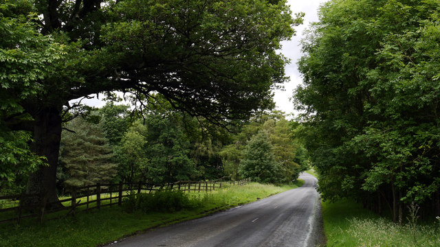
The character of the race is very much determined by the course and in the case of the Tour of the Reservoir also by the exposed nature of it as well. The riders HQ is in the village of Blanchland and they roll out of the village on the B6306 a climb out of the village and steady undulating road brings them to Carrick’s Corner at the head of the reservoir and here the race starts. The road climbs away from the reservoir itself and climbs steadily with a few switchbacks thrown in for good measure before dropping down into the village of Edmundbyres.
Here the route heads off downhill on the B6278 before turning right and riding over the dam of the Derwent Reservoir. From here they roll down from the dam to rejoin the B6278 next to the River Derwent, a short section of twisting road then opens out from a left hand bend to reveal the main climb of the route.
Starting as a gentle incline the climb gets serious as soon as the riders fork left off the B6278 and head up towards the Manor House pub on the A68. The climb is approximately 700m long and averages 8% gradient with a few kicks along the way. If the riders are lucky the prevailing wind will be on their backs, if not it will be even harder work.
The riders go onto the A68 and head north following the ridgeline for a short section before leaving the A68 onto and unclassified road heading up to Barleyhill, the highest point on the course. The road is undulating and exposed but the actual climbing is very gentle. At Barleyhill the riders make two left turns in quick succession and start to descend back to the reservoir. I hope some road repairs are done before the event as several large potholes could cause serious damage if not.
The riders will be flying as they turn and follow the northern shore of the reservoir past the yacht club before reaching a rolling section of road that takes them to the head of the reservoir. There are some beautiful views of the reservoir along this section however I don’t think the riders will have time to notice!
At the head of the reservoir the riders make a left turn to join the B6306 to head back towards Edmundbyers completing the lap. The finish of the race will be at the top of the dam, but with a revised way of getting there. Instead of turning off and riding over the dam itself the riders continue on the B6278 to the bottom of the valley and go over the river Derwent and then into the dam area. This gives a short climb to the finish at the top of the dam to crown a worthy victor.
The Parcours
View Tour of the Reservoir in a larger map

Much of the parcours is extremely exposed, making the going difficult in even relatively light wind due to the altitude. The prevailing wind around the reservoir blows from the north, meaning that the riders are likely to have to contend with crosswinds from the left for most of the route along the B6306 and B6278, a headwind along the A68, crosswinds from the right as they travel east along the northern flanks of the reservoir. There are numerous steep sections, including one greater than 10% approaching the finish line, as well as numerous steep descents and difficult corners. Combined, all of these factors make for a very technical and challenging parcours.
 |
| Guide to map symbols |
The race begins on the B6306 at the westernmost end of the reservoir, heading north-east - the low stone wall down a bank on the left side of the road and the spindly conifers beyond it will do little to calm cross winds blowing down the hillsides over the valley, across the water and straight into the riders' paths, possibly splitting the bunch into several groups only a few metres into the race if blowing with sufficient strength. The road also travels uphill here. After 0.5km, the route passes by some cottages on the left; 100m further on, where the road passes between woodland on both sides, there is a section where a small brook often overflows onto the road after heavy rain (1 Caution, marked by a yellow pin, on our map) - a potentially slippery point, but on a straight road and thus not especially hazardous. Crosswinds are likely to be even stronger when the riders emerge from the woods.
After 1.1km the parcours passes more woodland, then some buildings on the left before reaching the first bend, a fairly tight right-hander. A farm vehicle entrance right on the apex of the bend may cause mud on the road (2 Caution) and any small lead groups might be able to add a few seconds to their advantage at this point, being able to take advantage of the wind that, now blowing from behind, will allow them to sail up the short hill like land yachts while the riders in the pack behind them have to take things slower to avoid crashing. The road over the hill carries the race into what is unmistakably mountain moorland; at 2.49km, where a track leads off to the left (3 Caution; by the woods), there may be loose gravel on the road.
At 3.13km the road bends slightly right, then sharply left before entering a fast, sweeping left; the road is wide here and the bends can be taken at high speed. The green barn to the left of the road at 3.63km marks the beginning of the biggest and steepest climb so far - over the next 0.3km, the riders will climb 21m to 293m above sea level at an average gradient of 7.1%. The second half of the climb is steeper; according to Google Earth data, it reaches 10.4% at the slight right bend 3.85km into the parcours before slackening as it approaches the summit where a small lay-by provides an ideal spot for spectators*.
From 4.17km, the road starts to descend - the start of the descent is marked by a house high above on the right, but it's hard to see from the road; the first hundred metres is very steep in parts. Approximately halfway down the riders arrive at Edmundbyers where, 4.73km from the start, they keep left to follow the road as it veers to the east (4 Caution). Some caution is required here as riders who fail to brake in time from the descent run the risk of crashing into the metal railings running along the right-hand side of the road. Meanwhile, there is a danger of loose gravel along the left of the road.
5-10km
The road continues to descend through the village, reaching a left turn onto the B6278 at a T-junction (5 Caution; look for the "finger" signpost pointing left to Shotley Wood and the large red double doors on the house over the road) at 5.07km. The turn isn't difficult but the white lines painted on the road may become slippery when wet. The road then continues to descend, steeply in parts, for the next 1km before arriving at the left turn onto the road that will carry the race up to and over the dam.
 |
| The dam wall (image: Dennis Lovett CC BY-SA 2.0) |
At 8.22km, having reached the bottom of the descent, the riders negotiate a tight, fast left-hand bend to rejoin the B6278; they now follow the road as it begins to climb gently to 9.27km, where the biggest climb of the parcours begins. Rising 69m in 0.93km, the average gradient is 7.7%, which is plenty steep enough; however, Google's mapping data puts the steepest section (just after the left-hand turn at 9km) at 9.1% and while it's probably too far from the finish line for an individual to emerge as sure-fire winner, we are likely to see the group from which the winner is selected get away here during the final lap. On each lap, the first riders to the top will be awarded primes.
10-15km
 |
| Manor House Inn, at the top of the prime (image: Duncan Grey CC-BY-SA 2.0) |
The 0.8km from the turning is flat and ends at a fork where the riders will keep left to join a narrower road which remains flat for 0.5km, then climbs 19m in 0.5km (average 3.8%; maximum, in the second half, 6.2%). A short flat section then leads to 12.6km, where another short climb begins - due to the rough track crossing the road here, this may be a hazardous spot with mud and sharp stones on the road. The end of the road, at 13.3km and 306m above sea level, is the highest point on the parcours; the race turns left here and continues for 0.37km, with riders getting some much-needed shelter from the wind by the conifers on the right side of the road, before turning left again to begin the long descent that will take them along the northern side of the reservoir and towards the beginning of a new lap.
The descent, 2.4km long, continues past the next left turn (just past the large grey house and it's best to keep a short way out from the left verge as there are a few potholes in the road) and doesn't get very steep over the first 2km, thus allowing all but the most downhill-phobic climbers to retain any lead they gained on the preceding sections.
15km-End of circuit
The final 0.4km of the descent becomes much steeper, reaching -8.8% as the road follows a sweeping right-hand bend (9 Caution) - the road is wide enough for the bend to be taken at very high speed, but caution is required and with loose verges on both sides of the road the safest place to be is the centre. Unless it's raining, of course, in which case the white lines are going to be slippery.
Following the descent, as the road begins to bend gently to the left, the terrain flattens out considerably - there are a few small climbs, some steep, on the way around the reservoir but no more testing climbs to come for the next 3.5km. This, especially on the final lap, evens things up: any climbers that got away earlier can be caught (especially if they were one of the rare types that can descend, too) and it's a good opportunity for the teams to regroup and get their potential winners into position for the final assault on the finish line. At 15.9km, the reservoir comes back into view on the left; 400m later, with the reservoir once again hidden by trees, the riders come to a short but tough small climb of 0.2km with a maxiumum gradient of around 6% (white fences on both sides of the road mark the beginning and end). The short descent and flat 1km that follows is another point where climbers will have to work hard to maintain a lead.
 |
| Descent to the bridge, Carrick's Haugh (image: Trevor Littlewood CC-BY-SA 2.0) |
Final section
After completing three laps of the circuits, the riders will take a different route (marked in red on our map) to the finish line. Beginning at Carrick's Corner, they take the same route towards the dam but this time do not turn left to ride up onto it at 6.08km. Instead, they continue along the B6278 for 0.87km to the point where, earlier, they rejoined the B6278 following the descent down from the dam. Here they turn left, and the descent they tackled earlier, with its maximum gradient of 13%, becomes an ascent that is more than tough enough to shake up the order at the front of the race. The finish line is at the dam.
*Note: The lay-by only really has room for one or two cars. That means, of course, that there's space for about a hundred bikes - so if you're planning to see the race from that point, get there on your bike if you can so that other people will be able to do the same. The more the merrier - take a barbecue and some beers and have a party.
Start List
Not yet available
Getting There
Please note: Derwent Reservoir (County Durham/Northumberland) should not be confused with the reservoir of the same name in Derbyshire.
The parcours is best reached from the south via the A68, from the north via the A69, from the west via the A6079 and from the east via the A694, A692 or A693. Google Maps has an excellent application that can design routes suited to cars or bikes.
Staying There
The local inns offer accommodation, but this is very limited and likely to be booked up well in advance. There is a Youth Hostel at Edmundbyers and also Durham (37km), which as a popular tourist destination has several hotels. There is also a campsite (tents and caravans) at Edmundbyers (postcode DH8 9NN), but people planning to camp should be aware that the weather can be very bad in April.
No comments:
Post a Comment